Showing posts with label Outoors. Show all posts

Monday, January 25, 2016

Western Morning, Southern Afternoon

While the East Coast got pounded by record-breaking blizzards, we were enjoying an absolutely blissful weekend here in Boulder. It was sunny and clear, and although the mercury topped out in the mid-50s, it felt much warmer than that when one was in the sun. It was a perfect day for a hike, so I packed Mischa into the car and joined some friends at a trailhead a mere eight minutes' drive from our house. The park is called Chataqua and it's criss-crossed with trails that lead up to the nearby Flatiron Mountains. Here is Mischa, posed and ready for hour hike.


Most of the pictures I took ended up looking more like this, so I was pleased with the shot above:


Although the day was warm, the trail was very, very icy, but fortunately everyone in our group had the good sense to bring spikes. This is a product I didn't know even existed for most of my life, but in Boulder it's indispensable. I actually own two different types, one like the picture to the left and the other with smaller spikes under the ball of my foot and springs to dig into the snow that run under my heel. They're great because they're light enough to carry easily if you don't need them, but they make it possible to walk up slick surfaces that would be nearly impossible otherwise. We cruised by lots of hikers who were slipping and sliding along the trails and turning back early. Perhaps that is why the area wasn't as crowded as it ought to have been, considering the wonderful weather. We had a great time.

Mischa, who had no spikes, did an excellent job anyway. Ed and I had taken her up Mt. Sanitas, another nearby trail, earlier in the week, so this wasn't her first rodeo. Sanitas involves lots of scrambling over small boulders, and we were pleased that Mischa, who had never done anything like that as far as we knew, had little trouble picking out and executing a path over the rocks. She seemed to have a great time, and she was cheerful on our Saturday hike, too (which had no boulders to climb over and so was easier going). She hardly pulled on her leash at all, which is an improvement, was serene instead of anxious when passers-by attempted to pet her, and even did a fair job of ignoring many dogs we passed. (We still have a lot of work to do on this front.) She ended up muddy, tired, and happy.

Having worked up an appetite on the trails, several of our friends and I made a bar in South Boulder our next stop because they were hosting a crawfish boil. They do this a few times a year, apparently, and I will most definitely be back for the next one. Crawfish came in one-pound baskets or three-pound buckets, accompanied by corn on the cob (a little overdone) and boiled potatoes. I dispatched my own basket and part of a friend's, then helped Ed with a three-pound bucket. They were delicious and fun to eat. The only place I'd ever eaten crawfish before was a New Orleans-themed restaurant in Manhattan, so I have yet to rack up an "authentic" experience, but I'm not complaining.

Our bucket

I will be on the road quite a bit for the next few weeks, but I couldn't have asked for a higher note to go out on.

Saturday, September 19, 2015

Failed Fourteener

As Ed's friend Dave said to his son over our consolation breakfast in Boulder at 10:30 on Friday morning, "It's not about making it to the top, it's about making the right decisions." That about sums up our experience attempting to climb Long's Peak yesterday. We stayed low, but we also stayed alive.

Beautiful Long's Peak. The bare rock face is known as "the diamond."
Ed has been dying to climb Long's, something he hasn't done since his days as a camper at Cheley. He and his old camp friend Dave, who lives in Denver, planned together for several days, checking the weather, discussing our packing list, etc. Dave wanted to bring his ten-year-old son along, and so the two of them planned to sleep in the parking lot and get an extra-early start on Friday morning, just in case it took Jack longer to make the ascent. We planned to meet them at a feature called the Keyhole over halfway up and continue together from there. Ed and Dave checked in with each other on Thursday night and agreed that the chance of precipitation didn't worry them too much; there was a 25% chance, but there always seems to be a 25% chance.

Ed and I woke up at about 3:15 A.M. on Friday morning, dressed, and headed out the door. The trailhead isn't all that far away, and we were hiking by 4:50. It was, of course, pitch black (there wasn't even much of a moon), and so we hiked by the light of our headlamps, sometimes chatting and sometimes just enjoying the feel of the dark, silent forest around us. At some point, Ed asked if I was seeing raindrops. We were still under the cover of trees at this point, and after looking carefully I realized that I was seeing a drop intercept the beam of my headlamp every few seconds. I was surprised--I had been admiring the view of the stars in the cloudless sky not long before from the parking lot--but not too worried since the "rain" was barely noticeable.

The picture changed pretty dramatically by the time we got above treeline, though. We were about halfway up, and the sky had lightened enough to show us a mountain range cloaked in thick clouds. Worryingly, it was clear that the weather was headed our way. It was getting colder, too. I'd stripped down to a long-sleeved shirt, but since the rain had turned into pelting little ice balls, I called for a stop and reached down into my backpack to extract my raincoat. Out of the corner of both eyes, I saw a bright flash. "Was that lightning?" I asked nervously. A few moments later, we heard a boom. "I think that was about five seconds," Ed said. Yikes. Not right on top of us, but the storm was headed our way and we were above treeline, setting us up to be lightning rods.

Note the white streaks whipping by Dave - ice balls!
We waited for a while to see whether it would clear up or get worse. The ice balls (I maintain that they were not snowflakes) continued to abrade my face and standing still was making me colder and colder. A thick, white layer was accumulating on the ground. Right around the time we heard a second boom of thunder, a group passed by us, headed back down the trail. They weren't taking any chances, they told us. Ed was pretty sure we should throw in the towel, too, but he was worried about Dave and Jack. Phone calls to them were not going through, and he finally managed to get a text message off but receive no response. I was pretty sure no knowledgeable mountaineer would stick around on top of a mountain with his kid in tow in a lightning storm, but Ed was worried they were waiting for us. Finally, after another five minutes of indecision (and another rumble of thunder), we agreed that I'd start for the car while Ed went up the trail to try to find them. I wasn't thrilled about this, but I'd forgotten to bring hand warmers and my gloves were soaked through. I was eager to put my numbing hands in front of the car's heating vents.

Our intended route
The day was predicted to be beautiful after about 9:00 A.M., and it did start to clear as I got lower and lower. Still, it was too late in the day to attempt to summit Long's (afternoon thunderstorms are the norm around here, so it's important to summit early), and we wouldn't have been able to get to the top even if things had cleared up earlier. The ascent requires lots of scrambling over boulders and shimmying along narrow rock passages, which are a little dicey when dry and not to be attempted when wet. I passed hikers headed up as I went down and nearly all of them quizzed me on the conditions up above. Although my report was grim, no one seemed to worried since they were all going to Chasm Lake, which is under the treeline. Several told me that they'd passed a steady stream of would-be Long's hikers sadly trudging back to their cars.

I was thrilled to reach the parking lot and crank up the heat in the car. Ed, Dave, and Jack appeared about 45 minutes later. When they'd gotten Ed's text they had already been on their way down, as it turned out, and so Ed had joined them for the rest of the descent. Disappointed but resigned, we drove into Boulder for a massive breakfast and pity party.

Oh well.
The nice thing about living here is that we have easy access to Long's, and distance won't prevent us from going back for another attempt any time. It may be too late this season, though, so we'll have to be patient. (It is definitely possible to climb in winter when there's a thick layer of snow covering everything, but that requires a great deal of technical climbing and gear and is a whole different ballgame.) One of the most disappointing parts about the day was missing out on the views, both of the land spread below us and the mountains looming in front of us, which is one of my favorite parts of climbing. Everything was just too cloudy this time. But I look forward to many more attempts of Long's and of Colorado's other high-elevation playgrounds, some of which will certainly end in failure but some of which will make me feel as though I'm on top of the world.

Monday, August 3, 2015

First Fourteener: Mt. Elbert

My legs are aching, but my weekend was so much fun that I don't mind. I joined a group of five friends to climb my first--but not my last--Colorado "fourteener," and though I am not literally on top of the world anymore, I feel as though I am.

A fourteener, usually written as "14er," is a mountain that is at least 14,000 feet high. There are 12 in California, and Colorado has a whopping 54 of them. My dad and I climbed 14,180 feet to summit California's Mt. Shasta several years ago, but the peak we chose for this weekend, Mt. Elbert, is even higher. The tallest of all the 14ers in Colorado, it soars to 14,439 feet. Just because it is the tallest does not mean it is the most difficult, however. Actually, Elbert is regarded as one of the easier 14ers to climb because going up it doesn't really require climbing at all. It's really just a very long, very steep hike, and seemed like a good one for our group, which is active but contains different fitness levels.

Our route

On Friday, we drove three hours southwest (should have been closer to two, but we hit the traffic that chokes 70 every Friday when residents of the Boulder/Denver area head to the mountains in throngs) to Leadville, CO (circled in red), where we camped for the night at a very crowded campground. Car camping often leaves a lot to be desired in terms of peace and scenery, but you can't argue with the convenience. We brought coolers filled with food and had a luxurious meal cooked over an open fire before turning in around 10:00 P.M. Sleep, alas, didn't come easily for most of us, as conversations from neighboring campsites were broadcast at us on all sides. We got our revenge, though, when we emerged from our tents at 3:00 A.M. to dress, eat, and prepare for our big day. I packed sunscreen, chapstick, toilet paper, layers of clothes for various conditions, several wildlife guides, binoculars, three liters of water, and an absurd amount of food.

Afternoon thunderstorms are very common in Colorado, and being caught above tree line when they strike can be deadly. Lightning has been particularly pernicious this year, and so an early start to a long, high hike is critical; at all costs, one must be below treeline if a storm hits to minimize the chances of being struck. We blearily drove to the parking lot at the base of Mt. Elbert and started our walk at 4:17 A.M. I can't imagine hiking those first few miles without headlamps, but the full (blue!) moon was bright and two hikers without lamps passed us after about an hour. We were all feeling the effects of the elevation (about 10,000 feet) from the word go, even during the mile it took us to reach the trailhead. We tried to keep the pace moderate and stopped to catch our breaths occasionally. I could feel my heart pounding against the chest strap of my backpack.

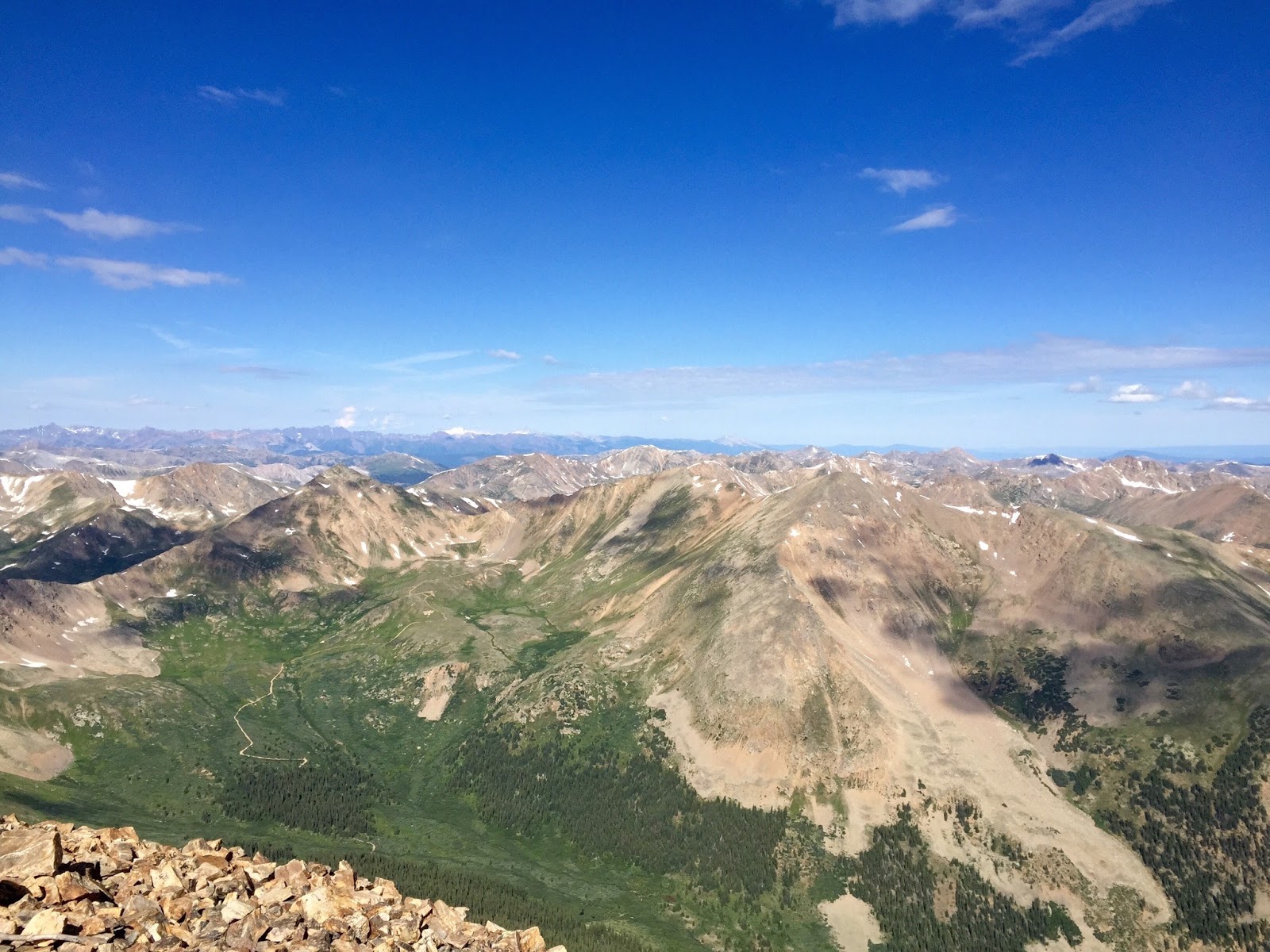
We were nearing the treeline when the sun began to rise. This was one of my favorite parts of the day: ahead of us, the full moon was setting over the peak we were bound for, and behind us the lush landscape was flushed with exquisite pink light. We stopped, speechless, to gaze at the nearly unbelievable beauty around us.


About half an hour later, we passed treeline and found ourselves in a sloped, expansive alpine meadow generously freckled with white, blue, yellow, and purple wildflowers. We'd agreed that we'd stop to eat and rest at this point and so, exhilarated by the beauty and the break, we wolfed down trail mix and dried fruit, drank as much water as we felt we could hold, shed layers and put on sunscreen. It was shaping up to be, as they say in Colorado, a bluebird day: barely a cloud in the rich blue sky.

We continued to ascend. Luckily, Lindsay had done lots of research and we knew that the peak we saw ahead of us was a false summit; in reality, Elbert's summit was at least 45 minutes past that. Gradually, the grass and flowers began to thin, replaced by scree fields and dusty gravel. In summer, hundreds of people climb Mt. Elbert each weekend, so the trail is well established. When we paused to peek behind us, we could see a steady stream of hikers lining the trail. Our early start had guaranteed us a few initial hours of solitude, but as a few of the group began to struggle more with the altitude, we slowed and others hikers caught up to and passed us. Nearly everyone was friendly, cheerfully wishing us a good morning and commenting on encountering so large a group of women on the trail.

The trail got steeper and steeper, and our talk turned to discussion of how we were dreading coming back down the slippery, dusty gravel.

Approaching the false summit
The top of the false summit afforded us a view of the nearby second false summit (argh!), but we were over that in short order and beheld, at last, the highest point in Colorado. The so-called "ridge" that connected the two was none too narrow but plenty steep, but adrenaline fueled us up the final ascent and at last we stood on top of Colorado!

Christina, Liz, Lindsay, Rikki, Beth, and Candice celebrate at the top!
The summit was pleasantly spacious, which was a good thing because plenty of people had beaten us to it. After looking around a bit, I found a boulder that seemed particularly large and stood on it, savoring the fact that my head rose above everyone else's; I was higher than anyone in the state, and taller than nearly everyone in the lower 48. Only a person standing on top of Mt. Whitney in California would outstrip me. I had guessed that the views would be unparalleled, but they were even more astounding than I could have imagined. I gaped.


Although it was only 9:45, we sat on boulders and ate "lunch." Most mountaintops are windy and cold, but we felt hardly a breeze in this enchanted place. Several of the girls talked about being tempted by the thought of a nap. But we knew that the single grayish cloud drifting innocently toward us could proliferate at the drop of a hat, and so, a bit sadly, we began the descent.

It was nice to go downhill for a while, but we quickly grew tired of our slow progress. One has to take tiny, mincing steps to avoid sliding down such slopes, and it was both exhausting and nerve-wracking. At long last, the trail became a little more solid, and we breathed a little easier as we passed through the alpine meadows again. It seemed to take forever to reach the treeline, and even longer to get back to the parking lot. Perhaps it was fatigue, or the fact that we had hiked the first hour-and-a-half in the dark, but the way down seemed to be much, much longer than the way up had been. I accepted the sight of a row of parked cars through the forest with the same enthusiasm as a desert traveler spotting an oasis.

All told, we hiked 11.5 miles and gained about 4,000 feet of elevation. Our leisurely pace meant that our total trip clocked in at 9.5 hours, but I'm confident I could have done it in less than that had I been alone. We celebrated with beer and pizza in quaint Leadville, then cleaned ourselves up at the campsite and enjoyed a fire until exhaustion forced us into our tents. The morning found us refreshed but sore, and my aches amplified as they day progressed. Walking downhill elongates muscles in a way that my frequent running and yoga hadn't prepared me for. Despite my complaining quadriceps, I am determined to climb many more 14ers. Lots of people make it their mission to "bag" all of them, and while I'm not motivated by a checklist, the experience was wonderful in myriad ways and I can't wait to have a bird's eye view of Colorado again. Luckily, I don't have to wait long. The same group, give or take a few, will drive to Fairplay, CO next weekend to take on three of them!

Sunday, November 2, 2014

First Hike on Mt. Sanitas

My parents flew in a few weekends ago--yes, this post is much overdue--to keep me company while Ed was out of town. It can be hard to entertain guests in a place one doesn't know well, but the weather was predicted to be gorgeous and so I decided a hike was certainly in order. I settled on the Mt. Sanitas Trail because I'd heard some fabulous view of Boulder could be had from the top. It was only about three miles, but with more than 1300 feet in elevation gain, it was rated as a difficult hike. A short, difficult hike is almost always do-able if one has ample time, though, so I figured we'd make a day of it.

We got a later start than I'd hoped to after a leisurely lunch on Pearl Street, then had trouble finding the trailhead which is unhelpfully labeled "Centennial." But finally, after much ado, we set off at somewhere between 3:00 and 3:30. Sanitas is tough because it is so steep, something I'd read and was able to confirm within the first few minutes.


 However, almost we were rewarded with pretty views from the get-go, too. I'm sure it's a scenic hike any time of year, but it's hard to imagine the scenery being lovelier than it was for us in early fall on this perfect day.


Mt. Sanitas is one of the most popular trails in the Boulder area and it's well maintained for the most part. But as we gained elevation, things got a little more rugged.

This is MUCH steeper than it appears in the picture.
 We soldiered on, stopping frequently to pant and admire the view. I'd been in Boulder for about ten days and was still struggling in the thinner air, so I can only imagine what my sea-level-dwelling parents must have been feeling. Still, they were upbeat and said they were enjoying themselves.

Enjoying the first aerial view of Boulder
Enjoying her cell phone
 We made it to the top of the ridge, then followed it as it continued to climb. Multiple false summits kept us guessing, but at long last we couldn't go any higher and realized we'd done it. Boulder lay out before us, a verdant quilt dotted with bright flames of yellow and orange. In the distance, things grew hazy, and we guessed that Denver lay below the smoggy layer. (I was glad we'd chosen to live a little higher.) A fellow hiker lent me his binoculars. I could see the community garden in my neighborhood, but there were still too many trees to spot the house itself. I resolved to come back nearer the end of fall to try again.


I've always found hiking downhill to be harder, and this hike was no exception. Things were steep, and gravel and dust in places forced us to take our time. Luckily, we'd planned our route wisely. We were hiking a loop, and we'd done the rocky part first. Starting on the Mt. Sanitas Trail meant that we'd finish on the Sanitas Valley Trail, a relatively gently sloping dirt road. After losing the trail in some rocks and getting increasingly nervous about the gathering dark, we finally made it to the switchbacks that heralded the beginning of the Valley Trail.
Dad, alas, didn't make it. But he had a good run.
 We made short work of what was left of the trail and arrived back at the car in semi-darkness. It had gotten much colder, and, not thinking we'd be out as long as we were, I hadn't packed warmer layers or headlamps. Luckily, though, there were no mishaps, though even if there had been the trail is popular enough that other hikers would have been able to get help for us. Dinner at Salt is always good, but it tasted even better than usual after our big afternoon.

The following day called for a mellower excursion, so we drove to the Bobolink Trailhead in south Boulder. I'd run on it a few times and it's flat and beautiful.


I'm still getting used to the idea that all this beauty is just minutes away from my house! Central Park was pretty and all, but it's pretty awesome to have the Flatirons in my extended backyard.